
In 2014, a never-before-seen eruption of a subglacial lake burst through Greenland’s ice sheet.
It left a 25-meter mound of ice and giant crevasses in its wake. Scientists were astounded as they had not observed this phenomenon before. This discovery challenges what we know about glacial melt and signals faster climate change and rising sea levels worldwide.
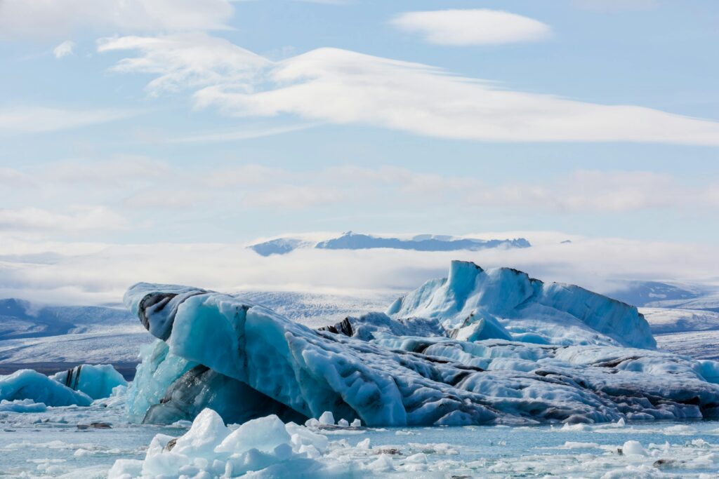
The massive Greenland meltwater explosion left permanent scars on the ice and opened new questions about the ice sheet’s hidden dynamics. Greenland’s ice sheet is the largest in the Northern Hemisphere, containing enough water to raise global sea level by up to 7m if it melts entirely.
What Happened in 2014?
In July and August 2014, satellite images revealed the sudden appearance of a crater, 85 meters deep, on Greenland’s surface. The crater was caused by a huge torrent of meltwater that exploded upward, instead of typically draining beneath the ice. The flood left 25-meter mounds of ice and giant crevasses in its wake.
Often during the warm season, as glaciers melt, the water trickles through crevasses to the bedrock and ice. Scientists quickly realised that what they had observed was the first-of-its-kind, a new type of subglacial eruption. Researchers only became aware of the event through satellite imagery. Such floods would go unnoticed on the ground in Greenland’s remote north.
Detecting the Eruption
Researchers first spotted the crater in satellite photos. Malcolm McMillan and his team from Lancaster University, UK, began investigating the sudden appearance of the 85-meter deep crater. They used satellite data and computer models to reconstruct the sequence of events. About 1 kilometer downstream, the team saw more disruptions in the ice. This careful detection work allowed them to piece together what had caused such immense changes on the ice sheet.
How Subglacial Lakes Erupt
Normally, meltwater beneath Greenland’s glaciers drains to the bedrock and flows out to sea. This time, water pressure inside the subglacial lake increased until it forced water to escape upward, breaking through fractures in the overlying ice. “What seems to have happened here is that when you put water into a situation where the ice was kind of frozen in the surrounding region, you could actually build up a lot more pressure,” McMillan explained. This pressure led to the upward burst. This event released the amount of water that would pass over Niagara Falls at full force in 9 hours, in just 10 days.
Craters, Crevasses, and Ice Towers
The eruption created massive changes to Greenland’s ice sheet. Researchers found 25-meter-high ice blocks torn from the surface and scattered across the area. Deep fractures split the ice sheet where the water had forced its way through. Giant crevasses and ice towers as tall as a five-story building are scattered across the ice sheet where water once flowed. The crater stretched 85m deep and nearly 2km² wide, twice the size of New York’s Central Park.
Rethinking Meltwater Models
The Greenland meltwater eruption forces scientists to completely rethink how ice sheets work. It also forces scientists to re-evaluate how much water Greenland can release and how quickly. Current computer models that predict future ice behavior do not account for water erupting upward through ice. The models hold the assumption that water always flows downward from surface to bedrock to ocean.
Read More: Antarctic Ice Sheet Nears Collapse, Scientists Warn of Global Consequences
Greenland Meltwater and Global Sea Levels
Greenland’s ice sheet, if completely melted, could raise sea levels by up to 7 meters. The ice sheet already contributes significantly to rising seas, losing about 267 billion tons of ice yearly since 2002. Recent studies predict sea level rise of 3.2 to 22.8 centimeters from Greenland by 2100.
Even small, sudden meltwater releases can accelerate ice movement and disrupt ocean currents, putting coastal cities worldwide at greater risk. Greenland’s meltwater significantly influences the Atlantic Meridional Overturning Circulation (AMOC), affecting weather and climate systems far beyond the Arctic.
Watching a Changing Landscape
The event was detected thanks to advanced satellites and frequent Arctic monitoring. Tools like CryoSat and ICESat-2 allow scientists to spot rapid surface changes and even track ice sheet movement from space. Data comes from multiple satellites, including CryoSat, Sentinel‑1, Sentinel‑2, and ICESat‑2.
Continual improvements in imagery interpretation help scientists monitor changes more accurately. Together, these advancements enable them to spot such events as they occur. Without this technology, such eruptions would go unnoticed. Danish and European agencies use these data to further understand how the Arctic is evolving under climate stress.
Global Implications and the Need for Further Study
The 2014 eruption may signal what happens as global temperatures continue rising. As Arctic temperatures warm faster than anywhere else on Earth, Greenland experiences more extreme melt events. The ice sheet now melts 8 days earlier and refreezes 31 days later than historically normal. Meltwater’s unpredictable behavior could accelerate glacial movement, reshape global coastlines, and lead to more abrupt climate shifts than scientists previously forecasted.
Read More: Scientists Say Gulf Stream May Be Near Collapse, Here’s Why That’s Dire for the Planet